

Quick answer (TL;DR)
The short list: drive GA-60 north to the Chestatee Overlook, loop Wolf Pen Gap Road through Suches, and save a day for the Russell-Brasstown Scenic Byway while color builds toward the usual late-October peak. Come back for Gold Rush Days, October 17 and 18, 2026, on the Public Square. Hike to Amicalola Falls or Helton Creek. End the day in Georgia wine country. State foliage reports start October 1.
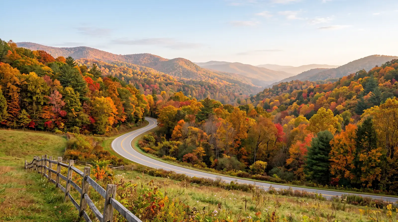
Fall in Dahlonega runs on elevation. Color starts at the highest peaks and works downslope roughly a thousand feet a week, so leaf drives, waterfall hikes, and the Gold Rush Days festival can share one October weekend an hour north of Atlanta.
Dahlonega sits about an hour north of Atlanta in what the state tourism office calls the heart of Georgia wine country, and it was the site of America’s first major gold rush. Every autumn it doubles as a leaf-peeping base with a schedule you can plan around. The USDA Forest Service, which manages the Chattahoochee-Oconee National Forest across north Georgia, describes fall color cascading down from the highest peaks, with peak color dropping roughly 1,000 feet in elevation every week. That one fact organizes a whole trip: you do not have to guess a single perfect weekend, you just pick your elevation.
This guide runs on that clock: the drives that put you in the color, the festival weekend worth booking early, the waterfalls that stretch the season, and the food and wine at the end of the day. For everything outside these six weeks, our things to do in Dahlonega year-round guide covers the full list.
When does fall color actually arrive?
Official Georgia sources give a typical window rather than a date. Explore Georgia, the state tourism site, puts it plainly: the mountain parks typically peak in late October, but color shows up as early as September and lasts through much of November. The Georgia Forestry Commission’s leaf reports from 2024 tracked the same shape, with the strongest change above 3,500 feet first, and elevations under 3,000 feet turning from late October into early November.
What about this year? Nobody official will say yet. The Forestry Commission does not open Leaf Watch 2026 until October 1, and the state parks Leaf Watch page was still a pre-season placeholder in late September. When the reports begin, they follow the elevation pattern: Black Rock Mountain State Park outside Clayton, at 3,640 feet Georgia’s highest state park, usually shows color before almost anywhere else, while F.D. Roosevelt State Park at Pine Mountain often waits until early November.
The Forest Service’s fall-color notes, updated August 14, 2026, lay out the recipe: a drier summer can set up spectacular color across the Appalachians, drier soils push reds toward their most intense, and cool September mornings followed by a clear, dry, cool October hold leaves on the trees longer. Mechanics, not a forecast.
The best fall drives from Dahlonega
GA-60 north: the Chestatee Overlook and Dockery Lake
Start with the road you can drive on a spare hour. GA-60 runs north out of Dahlonega; 11.7 miles up, just past the entrance to Dockery Lake Campground, the Chestatee Overlook opens a wide-angle view of the watershed that gives rise to the Chestatee River, with the campground in the foreground and the Blood Mountain Wilderness in the distance. The Forest Service calls it a great photo opportunity, and it is the closest place to town where you can read the color without leaving the car.
Dockery Lake sits just below the overlook. The Forest Service says thousands make the yearly October trek to the mountains near the lake, and its 11 campsites make this the easiest overnight on the corridor.
Wolf Pen Gap Road and Suches
The Forestry Commission’s fall reports keep recommending the same stretch: State Route 180, better known as Wolf Pen Gap Road, running from US-129/19 near Vogel State Park over toward Suches and passing Lake Winfield Scott, at 3,260 feet one of the highest-elevation lakes in Georgia. Georgia State Parks calls the twisting roads around Vogel, Wolf Pen Gap Road in particular, some of north Georgia’s prettiest fall scenery, and Vogel’s 2,500 feet at the base of Blood Mountain puts the park in the early-color band.
Two practical warnings for 2026. Vogel has a new visitor center under construction, and the state parks site says parking may be very limited this season, so arrive early or build the drive around the road itself. The Forestry Commission also cautions that clear piedmont sunshine often turns to fog and drizzle at the higher elevations, which can hide the views you came for.
Suches earns the loop. Explore Georgia calls it the valley above the clouds and suggests short hikes at Sea Creek Falls, Sosebee Cove, and Preachers Rock, a two-mile Appalachian Trail walk to a rocky outcrop with 360-degree views and the summit of nearby Big Cedar Mountain. The state’s own fall road trip returns from Suches via Highway 60 and US-19 into Dahlonega.
The Russell-Brasstown Scenic Byway
For a full day, drive the Russell-Brasstown National Scenic Byway, a 40.6-mile loop through the eastern Chattahoochee National Forest on State Highways 348, 180, and 17/75. The Forest Service suggests allowing at least three hours, and the Federal Highway Administration confirms no fee is required just to drive it. Brasstown Bald, Georgia’s highest point at 4,784 feet, anchors the loop; on a clear day the observation deck reaches four states. An $8 fee covers park entry and the shuttle bus, or you can walk the half-mile Summit Trail, and the summit webcams make it a useful color check before committing the day.
The rest of the loop stacks up quickly. The byway crosses the Appalachian Trail at Hogpen Gap, Dukes Creek Falls sits a 2.2-mile round-trip walk from its trailhead, Anna Ruby Falls offers its rare 150-foot twin falls at the end of a 0.4-mile paved path, and the Bavarian-themed town of Helen breaks the drive about halfway. Most of the trailheads near Dahlonega hang off these same corridors; our guide to the best hiking trails near Dahlonega sorts them by length and difficulty.
Gold Rush Days, October 17 and 18
Dahlonega’s largest festival of the year lands on the third full weekend of October, which in 2026 means Saturday and Sunday, October 17 and 18, and this is the 72nd edition. Vendors line the Historic District around the Public Square; the visitors bureau and the festival committee count them differently, somewhere north of 200, so call it hundreds of art, craft, and food booths. Expect live music, gold panning, a parade, children’s activities, and Appalachian craft demonstrations.
The parade steps off at 3:00 PM on Saturday, October 17, staging in front of the Dahlonega Police Department and finishing in the University of North Georgia drill field circle. Festival hours run 9:00 AM to 5:30 PM both days per the published 2026 schedule, which also lists the Rotary 5K at 8:00 AM Saturday morning, a 4:30 PM concert that afternoon, and an arm-wrestling tournament on Sunday. One gap to know about: the organizers have not posted an admission price on their official pages, so verify at goldrushdaysfestival.com before you go.
The Dahlonega Gold Museum State Historic Site sits right on the square at 1 Public Square, open Monday to Saturday 9:00 AM to 4:45 PM and Sunday 10:00 AM to 4:45 PM, with admission of $10 for adults, $7.50 for seniors, $7 for youth 6 to 17, and $3.50 for children 6 and under, charged separately from anything the festival does. For the deeper rundown, a detailed Gold Rush Days festival guide covers the weekend piece by piece.
Waterfalls carry the season
Waterfalls stretch fall in both directions, since moving water looks better with color around it and the crowds thin once the roads quiet down. Amicalola Falls State Park northeast of Dawsonville is the headliner: 729 feet, which the park’s official lodge site describes as the third-highest cascading waterfall east of the Mississippi River, and only 8 miles from the Appalachian Trail. The park runs a guided autumn waterfall hike if you want the color interpreted.
Closer to the byway, Helton Creek Falls south of Blairsville pairs a walk of less than a mile with a double waterfall through hardwood color, Dukes Creek Falls stays a manageable 2.2-mile round trip, and Raven Cliff Falls suits a full morning at five miles round trip. For the river itself, the Chestatee rises in the watershed you saw from the Chestatee Overlook, and the GA-60 corridor tracks it out of town.
Food and wine after the color
Dahlonega is, in Explore Georgia’s phrasing, the heart of Georgia Wine Country, which makes eating and drinking here part of the fall plan. Our guide to Dahlonega wine country tasting rooms maps the stops worth building an afternoon around, and for dinner, where to eat in Dahlonega is the deeper list. Festival weekends fill tables early, so treat a Saturday reservation the way you treat the leaf forecast.
November deserves the second trip
The season does not end at Halloween. Georgia State Parks points to the 1.6-mile Laurel Ridge loop at Smithgall Woods, which opens a view of Mount Yonah once most leaves are off the trees, a quiet window most visitors never plan for. The Forestry Commission’s 2025 reports had Northwest Georgia at peak on November 6, with nearly all the overstory trees turned, and Explore Georgia’s typical-timing guidance runs color through much of November. Late trips also skip the festival crowds and the fog lottery.
Planning notes: reports, fog, parking
Three habits make a Dahlonega fall trip better. Start checking foliage reports October 1, when the Georgia Forestry Commission opens Leaf Watch 2026; the state parks Leaf Watch page and the Brasstown Bald webcams fill in the picture. Plan around fog, because the Forestry Commission warns it is common to have clear piedmont sunshine and fog in the high country on the same morning, so save the high overlooks for afternoons. And park strategically: Vogel’s construction limits parking this season, and the Forest Service calls the Blood Mountain approach the most heavily used portion of the Appalachian Trail in Georgia, with limited parking to match. For the in-town version of the season, how downtown Dahlonega does fall is the companion read.
Frequently Asked Questions
When is peak fall color in Dahlonega?
Typically late October for the mountain parks around Dahlonega, per Explore Georgia’s guidance, with color starting as early as September and running through much of November. Forestry Commission reports track the same pattern by elevation: the strongest color shows first above 3,500 feet, and elevations under 3,000 feet turn from late October into early November. For any given year, watch the state reports that begin October 1.
Is there a 2026 fall foliage forecast for North Georgia yet?
Not an official one. The Georgia Forestry Commission opens Leaf Watch 2026 on October 1 and publishes nothing dated before that, and the Georgia State Parks Leaf Watch page is still in pre-season form in late September. The commission did publish its 2026 Leaf Watch StoryMap on September 2, which is the tracker to watch once the reports start.
What are the dates for Gold Rush Days 2026?
Saturday and Sunday, October 17 and 18, 2026, the 72nd edition. The festival always lands on the third full weekend of October and fills the Historic District around the Public Square.
What time is the Gold Rush Days parade?
3:00 PM on Saturday, October 17. The lineup stages in front of the Dahlonega Police Department by 2:00 PM, and the route ends in the University of North Georgia drill field circle. It runs rain or shine.
Does Gold Rush Days charge admission?
The festival’s official pages do not list an admission price, so check goldrushdaysfestival.com before you go. The Dahlonega Gold Museum on the square charges separately: $10 adults, $7.50 seniors, $7 for youth 6 to 17, and $3.50 for children 6 and under.
What is the best fall drive near Dahlonega?
GA-60 north to the Chestatee Overlook for the closest view, Wolf Pen Gap Road (State Route 180) through Suches for the classic color run past Lake Winfield Scott, and the Russell-Brasstown Scenic Byway for a full 40.6-mile loop with Brasstown Bald on it. All three work as day trips from town.
Can you see fall color around Dahlonega without hiking?
Yes. The Chestatee Overlook sits 11.7 miles up GA-60 with the view from the roadside, the byway is a driving experience by design, and Brasstown Bald runs a shuttle to the summit; an $8 fee covers park entry and the shuttle bus if you would rather not walk the half-mile Summit Trail.
Is there a fall foliage map for Georgia?
The Georgia Forestry Commission publishes its Leaf Watch map each season, and the 2026 StoryMap went up September 2, with written reports starting October 1. Georgia State Parks runs a Leaf Watch page as well, and it links to a third-party national prediction map from smokymountains.com, which is not an official Georgia source.
Which waterfalls are best in fall near Dahlonega?
Amicalola Falls State Park near Dawsonville, a 729-foot cascade the park’s official site describes as the third-highest cascading waterfall east of the Mississippi River. Helton Creek Falls south of Blairsville pairs a walk of less than a mile with double waterfalls, and Dukes Creek Falls off the byway is a 2.2-mile round trip.
Is November too late for fall color around Dahlonega?
No. Lower elevations run later: the Forestry Commission’s 2025 season had Northwest Georgia at peak on November 6, F.D. Roosevelt State Park at Pine Mountain often peaks in early November, and the Laurel Ridge loop at Smithgall Woods is known for its Mount Yonah view after most leaves have dropped.
How far is Dahlonega from Atlanta?
About an hour north of Atlanta, per Explore Georgia’s city guide, which is why fall weekends fill quickly. The visitors bureau describes Gold Rush Days as drawing thousands of visitors.
What is there to do in Dahlonega if the weather turns?
The Dahlonega Gold Museum State Historic Site at 1 Public Square keeps regular hours: Monday to Saturday 9:00 AM to 4:45 PM, Sunday 10:00 AM to 4:45 PM. The wine country around town is the standard gray-day fallback, and the Forestry Commission warns that fog can hide the high-elevation views while the piedmont stays clear.
Fall weekends have a way of turning into house hunts. Compare homes for sale in Dahlonega with Gold Peach Realty, or call (770) 283-1223 to talk with a local brokerage about staying past the color.